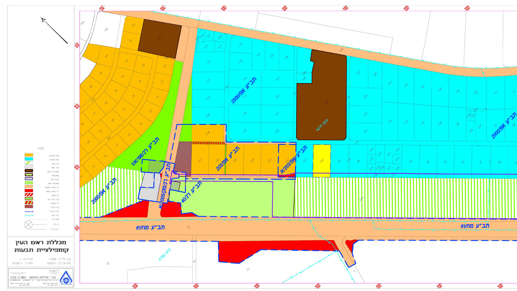
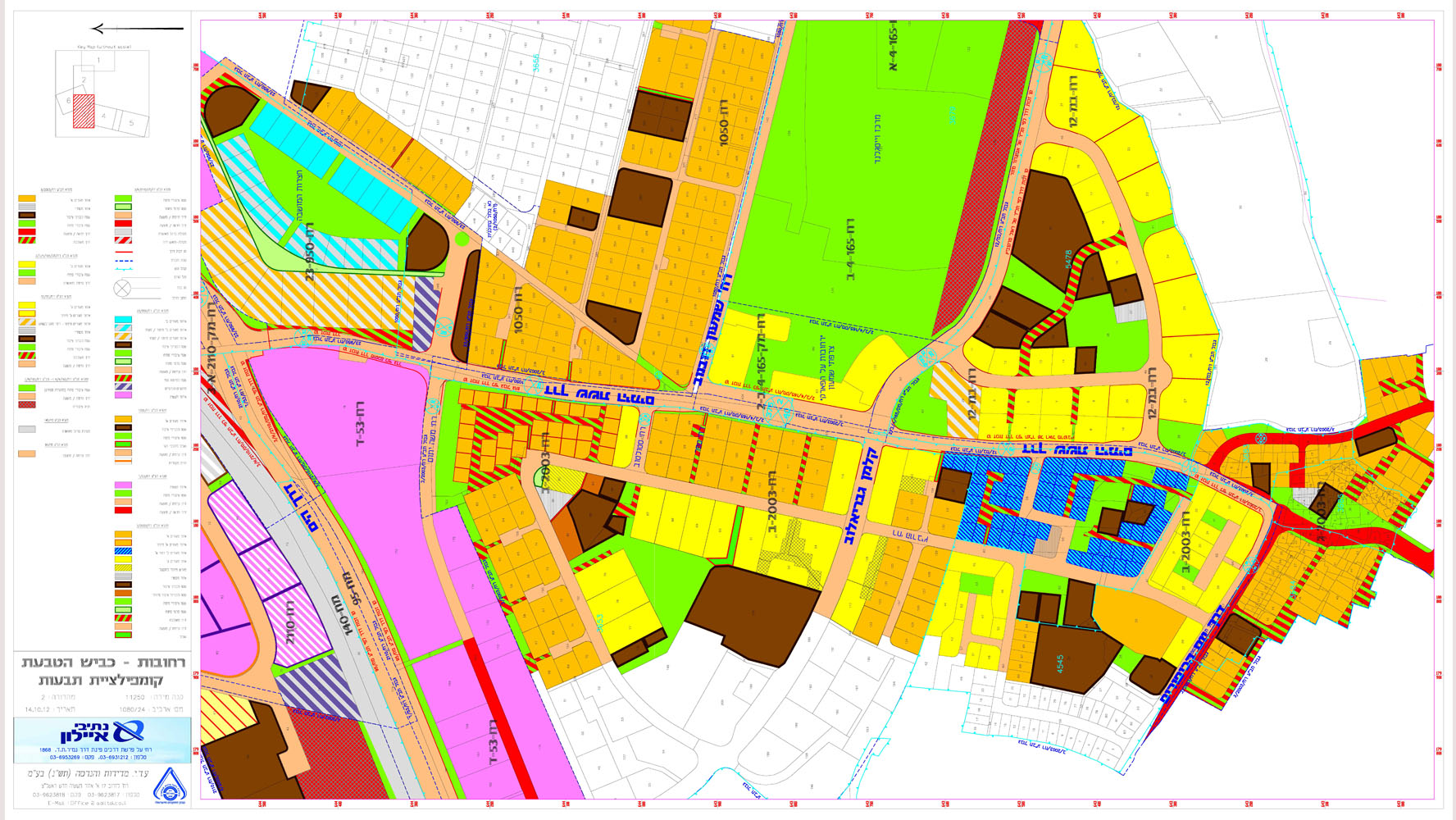
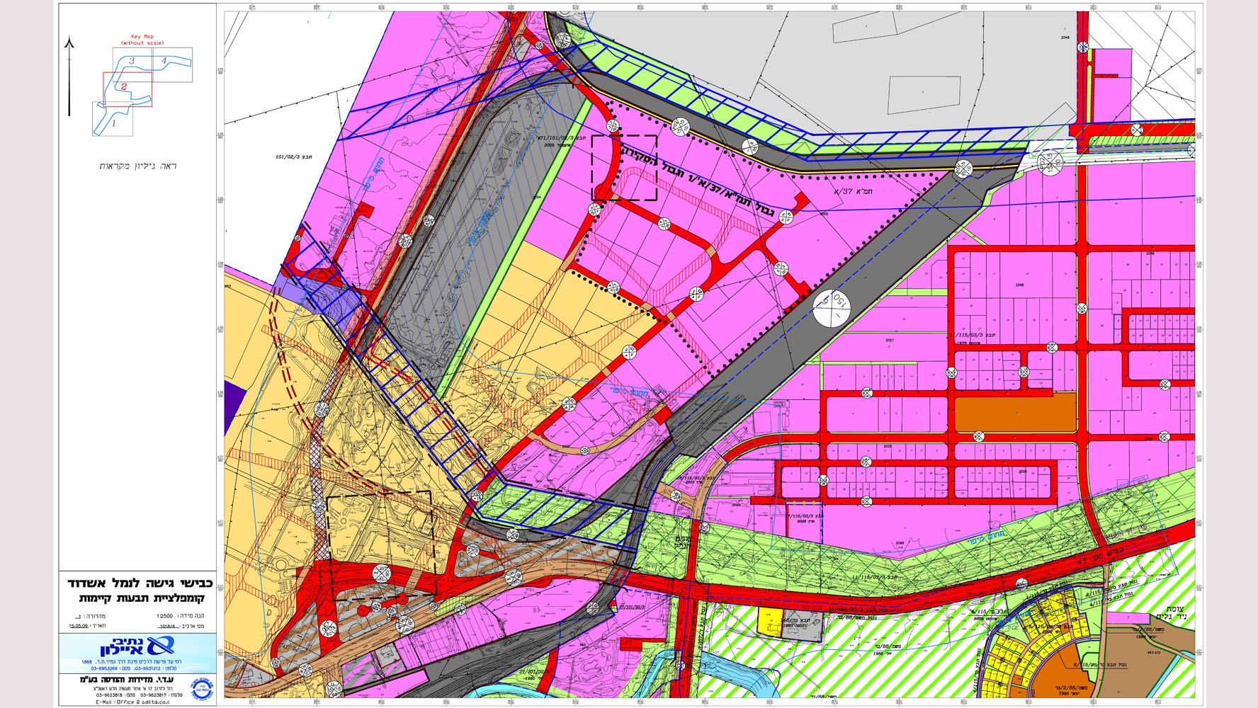
Map compilation means creating maps from other maps, which are generally larger in scale, or can be derived from original surveys and photogrammetric systems. These maps are sometimes referred to as derivative maps and may include information from various sources, in addition to maps from which they are mainly drawn.
Municipal maps, for example, usually represent original surveys, mainly done for engineering and construction control programs. However, some consist of extensions of the area’s topographic maps.
Notes on the sources from which the maps were drawn usually appear on complex maps. This sometimes includes a reliability diagram showing the areas for which good information was available and those that may be less reliable. Notes on certain features or areas that the editor determines may be helpful to the user may appear on the map itself.
Maps that reflect original surveys, such as a national topographic map series, include standard marginal information. Aerial photography, process and instrumentation dates, control notes, field edit date and other information may be included. References to the availability of nearby maps and maps in different scales can also be included.